Highways

Rodovia Bandeirantes (Bandeirantes Highway) is one of the main lines connecting S. Paulo city with the interior of the State of SĂŁo Paulo. The photo shows its entrance in the city of SĂŁo Paulo.

Rodovia dos Imigrantes (Immigrants Highway) connects the city fo S. Paulo to the ocean coast.
SĂŁo Paulo is crossed by 10 major Brazilian highways and automobiles are still the main means to get into the city. These roads are:
- Rodovia Presidente Dutra/BR-116 (President Dutra Highway) - Connects SĂŁo Paulo to the east and north-east of the country. Most important connection: Rio de Janeiro.
- Rodovia RĂ©gis Bittencourt/BR-116 (RĂ©gis Bittencourt Highway) - Connects SĂŁo Paulo to the south of the country. Most important connections: Curitiba and Porto Alegre.
- Rodovia FernĂŁo Dias/BR-381 (FernĂŁo Dias highway) - Connects SĂŁo Paulo to the north of the country. Most important connection: Belo Horizonte.
- Rodovia Anchieta/SP-150 (Anchieta Priest Highway) - Connects SĂŁo Paulo to the ocean coast. Mainly used for cargo transportation to Santos, the most important port of Latin America.
- Rodovia dos Imigrantes/SP-150 (Immigrants Highway) - Connects São Paulo to the ocean coast. Mainly used for tourism. Most important connections: Santos, São Vicente, Guarujá and Praia Grande.
- Rodovia Castelo Branco/SP-280 (President Castelo Branco Highway) - Connects SĂŁo Paulo to the west and north-west of the country. Most important connections: Osasco, Sorocaba, Bauru and Campo Grande.
- Rodovia Raposo Tavares/SP-270 (Raposo Tavares Highway) - Connects SĂŁo Paulo to the west of the country. Most important connections: Cotia, Sorocaba, Presidente Prudente.
- Rodovia AnhangĂĽera/SP-330 (Anhanguera Highway) - Connects SĂŁo Paulo to the north-west of the country, including its capital city. Most important connections: Campinas, RibeirĂŁo Preto and BrasĂlia.
- Rodovia dos Bandeirantes/SP-348 (Bandeirantes Highway) - Connects São Paulo to the north-west of the country. It's considered the best motorway of Brazil. Most important connections: Campinas (including Viracopos Airport), Ribeirão Preto, Piracicaba and São José do Rio Preto.
- Rodovia Ayrton Senna/SP-70 (Ayrton Senna Highway) - Connects São Paulo to east locations of the state, as well as the north coast of the state. Most important connections: São Paulo-Guarulhos International Airport, São José dos Campos, Caraguatatuba, S. Sebastião, Ilha Bela, Ubatuba..
- Rodoanel Mário Covas
São Paulo grew quickly from the 1940s to the 1980s and many roads and buildings were built without major planning. As a result, heavy traffic is common on the city's main avenues, and traffic jams are relatively common on its largest highways. The main means of commuting into the city is by car and by bus. Rodoanel Mário Covas, a road ring that circles the city, is being built to be an effective way of avoiding heavy vehicles traffic in the city, such as buses and trucks that crossed the city for other destinations. Part of it is ready connecting Via Anhanguera, Via Bandeirantes, Via Raposo Tavares, Via Castelo Branco and Via Regis Bittencourt.
Railways
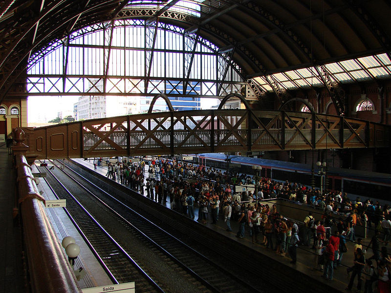
Luz railway station in Downtown SĂŁo Paulo.
There is an infrastructure project to build a high-speed railway service linking Brazil's two largest cities, SĂŁo Paulo and Rio de Janeiro. The trains would go as fast as 280 kilometres per hour (170 mph).(the trip would last about 1 hour and 30 minutes from S. Paulo to Rio).
Another important project is a medium-speed rail service (about 160 km/h) from SĂŁo Paulo to Campinas, which would reduce the journey time from the current one hour and a half by car to about 50 minutes by train. Linking the towns of SĂŁo Paulo, JundiaĂ, Campinas Airport, and Campinas city center, this service will also be connected to the railway service between SĂŁo Paulo city center and Guarulhos Airport and to the high-speed railway to Rio de Janeiro.
Major works on an express railway service between SĂŁo Paulo city center and Guarulhos International Airport were announced by the SĂŁo Paulo state government in 2007, which will be a milestone in the revitalization and improvement of the Brazilian passenger railway services.
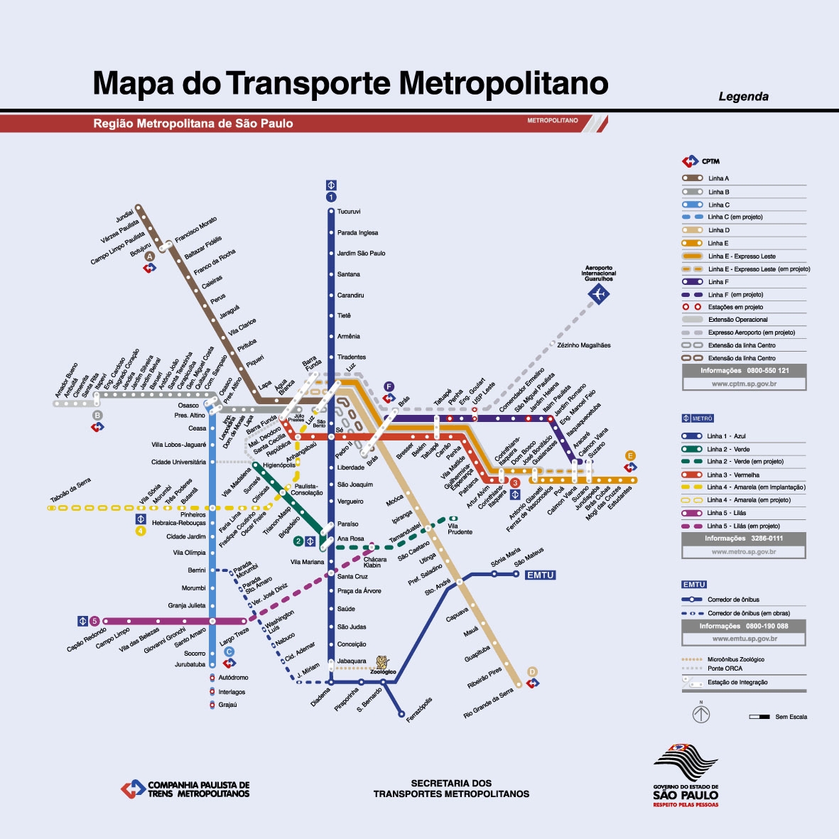
Map of the metro-rail network in SĂŁo Paulo (includes lines not yet built or under construction).